Art Maps: Past & Present
For years we've had a hand-drawn map of the Islands hanging on our wall. Perhaps you've seen the one?
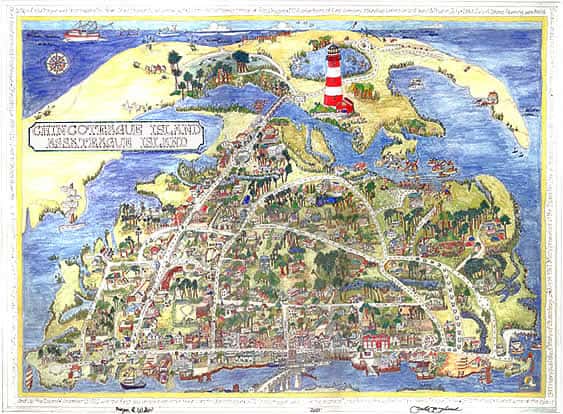
It's by Megan Willer and Zebie Hursh, and it's a fun, fantastical take on the Islands, complete with duck crossings, Maureen Beebe, and horseshoes marking the pony swim trail. We love it.
But our friend Jon from Sundial Books tells us that this map has gone out of print... and in the years since the map's creation, Chincoteague has changed quite a bit.
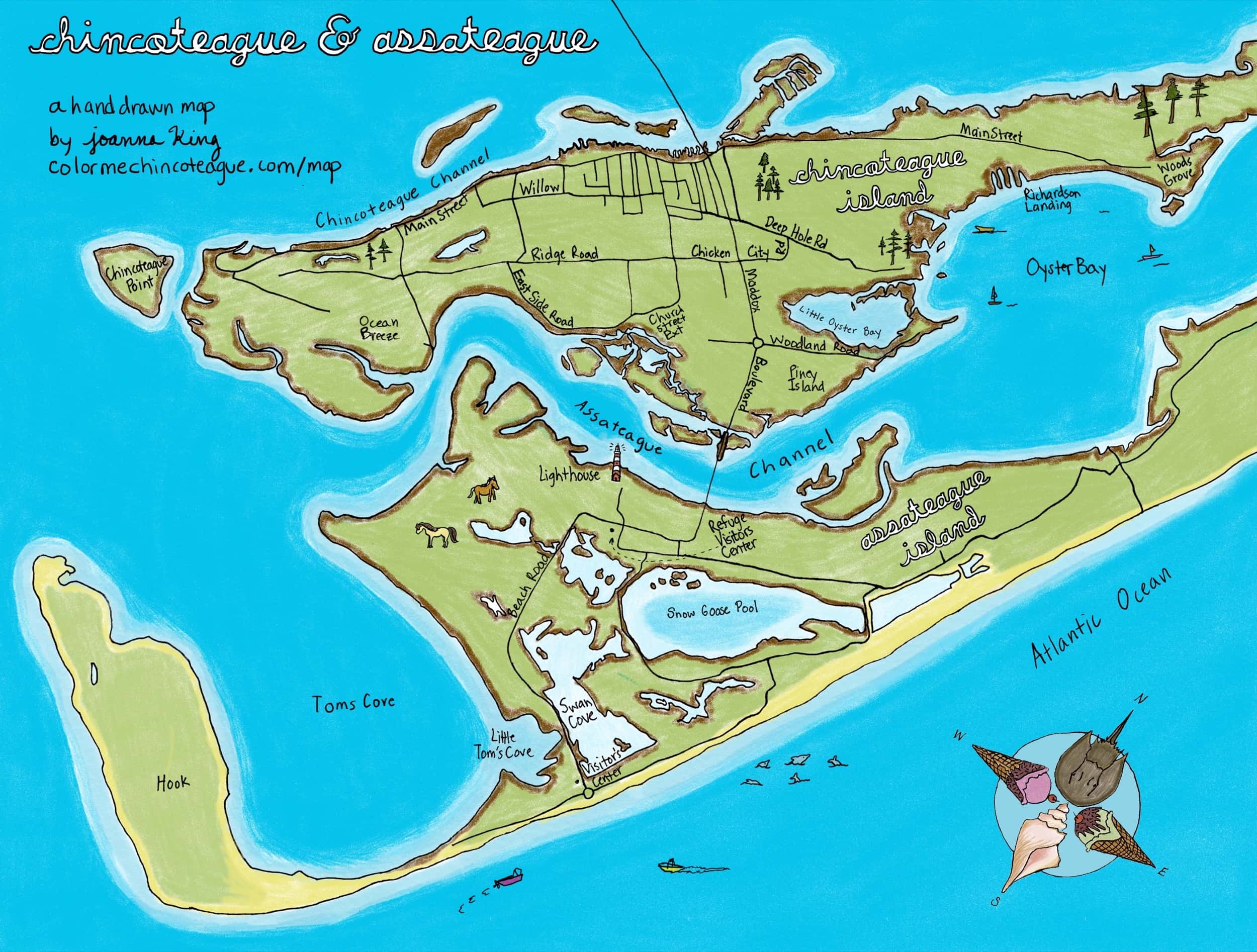
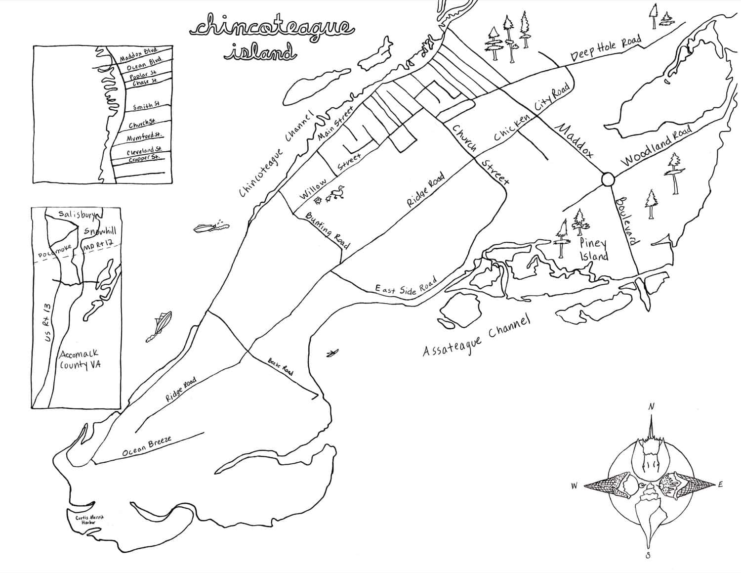
A Hand-drawn Chincoteague & Assateague Map
For the 2018 issue of Chincoteague Waves Magazine, Joanna had the pleasure of illustrating the centerfold maps of Chincoteague and Assateague.
The Chincoteague-and-Assateague map is largely informational and representational. We've heard of kayakers taking previous years' editions of Waves maps with them on the water, and we wanted to make something that could continue to serve that purpose.
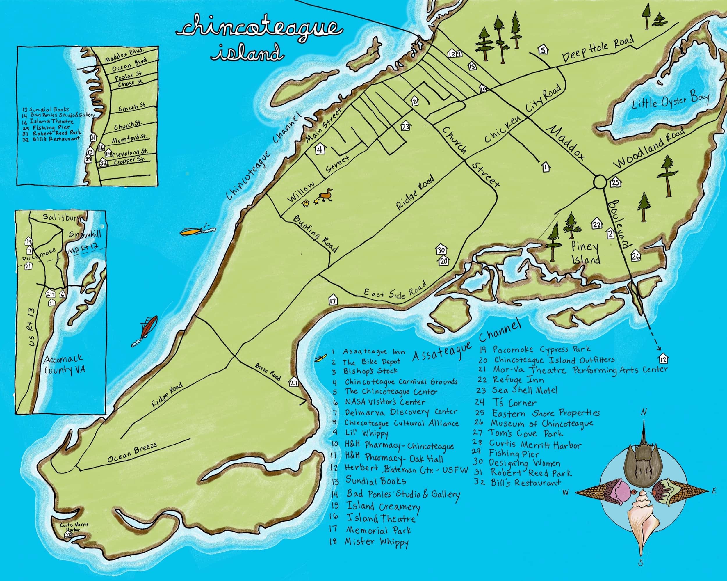
A Hand-Drawn Map Of Chincoteague
The Chincoteague-only map has an additional layer of info in Waves: all the local businesses that are advertising in the 2018 issue.
And just for you, dear reader, we also created black-and-white versions for you to color yourself and label with your favorite places!
B&W Chincoteague & Assateague Maps
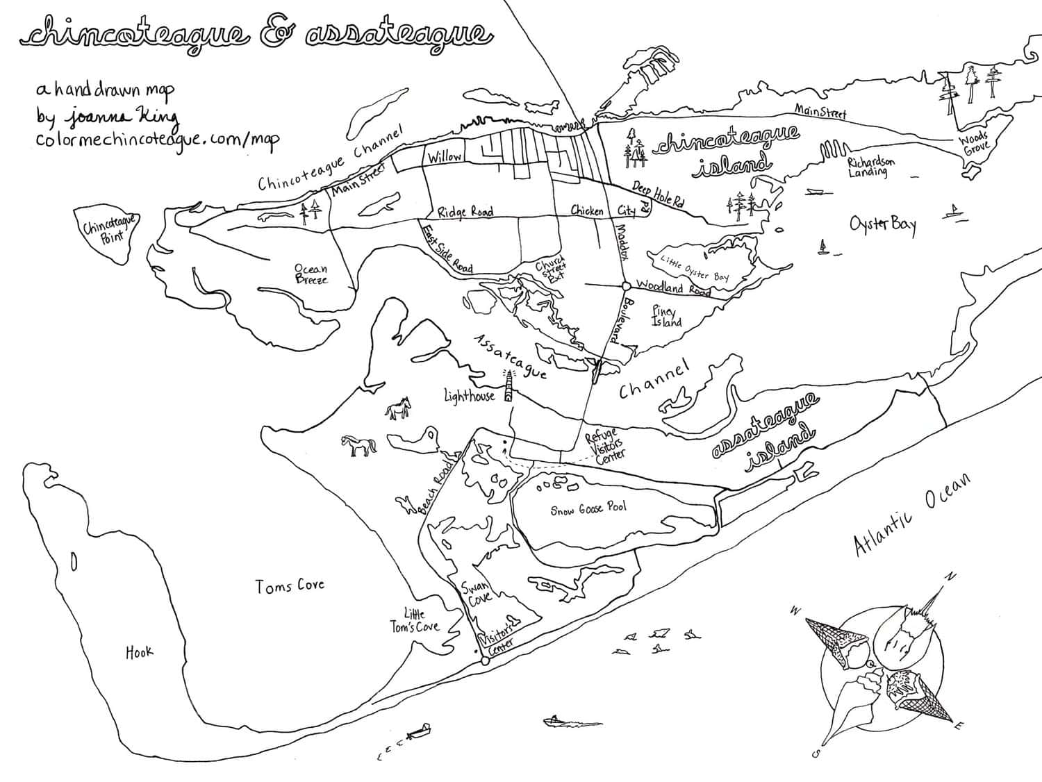
Download B&W and Color Maps here.
A Chincoteague & Assateague Coloring Book
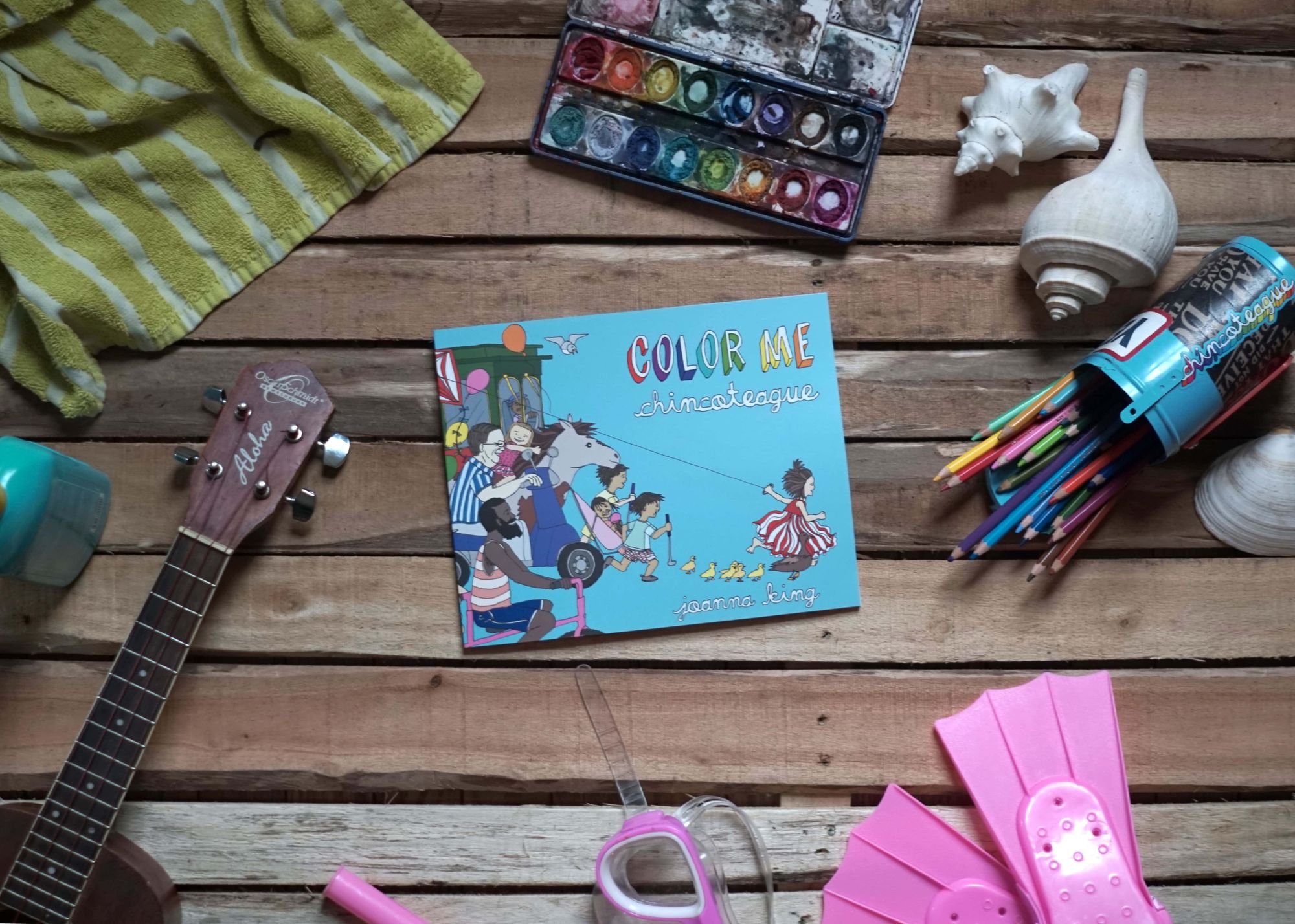
And, of course, if you like to color, you should pick up a copy of our coloring book! It’s a hand-drawn coloring book that celebrates the people, places, and events that make Chincoteague and Assateague awesome. With heavy 105lb paper and a Smyth-sewn perfect binding that flattens out easily, it's perfect for hours of coloring.